Advancing South India’s Global Agenda

China's Long Game in the Indian Ocean Region: Balasubramanian Chandrashekar
BackChina's Long Game in the Indian Ocean Region: Balasubramanian Chandrashekar
Issue Brief No: 03
China's Long Game in the Indian Ocean Region
Author: Balasubramanian Chandrashekar
India occupies a central and commanding position at the head of the Indian Ocean Region (IOR), the only major ocean named after a single country. This vast expanse forms the natural maritime boundary of the Indian subcontinent and has served as a conduit for deep-rooted trade, cultural, and civilizational exchanges between India and the littoral states since time immemorial. As the world’s third-largest water body, the Indian Ocean is endowed with abundant reserves of oil, natural gas, and critical seabed minerals, making it indispensable to global energy security and resource supply chains. It functions as a vital lifeline for international trade and transport, carrying approximately one-third of the world’s bulk cargo and two-thirds of global oil shipments through its critical sea lines of communication and chokepoints. In recent years, strategic and economic pivots have increasingly shifted toward the IOR, transforming it into the central theatre of major-power rivalry and intensifying geopolitical competition in the maritime domain.
China has significantly expanded its engagements across the Indian Ocean Region (IOR) over the past three decades, transforming its presence from limited anti-piracy operations into a sustained and multifaceted strategic footprint. Through a combination of growing naval deployments, extensive port infrastructure investments under the One Belt and One Road (OBOR) Initiative, Beijing has steadily acquired meaningful military advantages far from its home waters. These advantages include access to strategic logistics nodes, enhanced replenishment capabilities, and potential basing or support arrangements in several littoral states. At the same time, China is actively pursuing a wide range of military capabilities tailored for operations in the IOR, including advanced surface combatants, nuclear-powered submarines, auxiliary oil replenishment ships, and long-range maritime patrol aircraft. Complementing these overt military developments, China is also building an array of dual-use capabilities—such as persistent research and survey vessels, seabed mapping programs, distant-water fishing fleets, and space-based surveillance assets—that provide valuable intelligence, domain awareness, and logistical support in peacetime while retaining significant utility for higher-end military missions during periods of tension or conflict.
China’s Defence White Papers
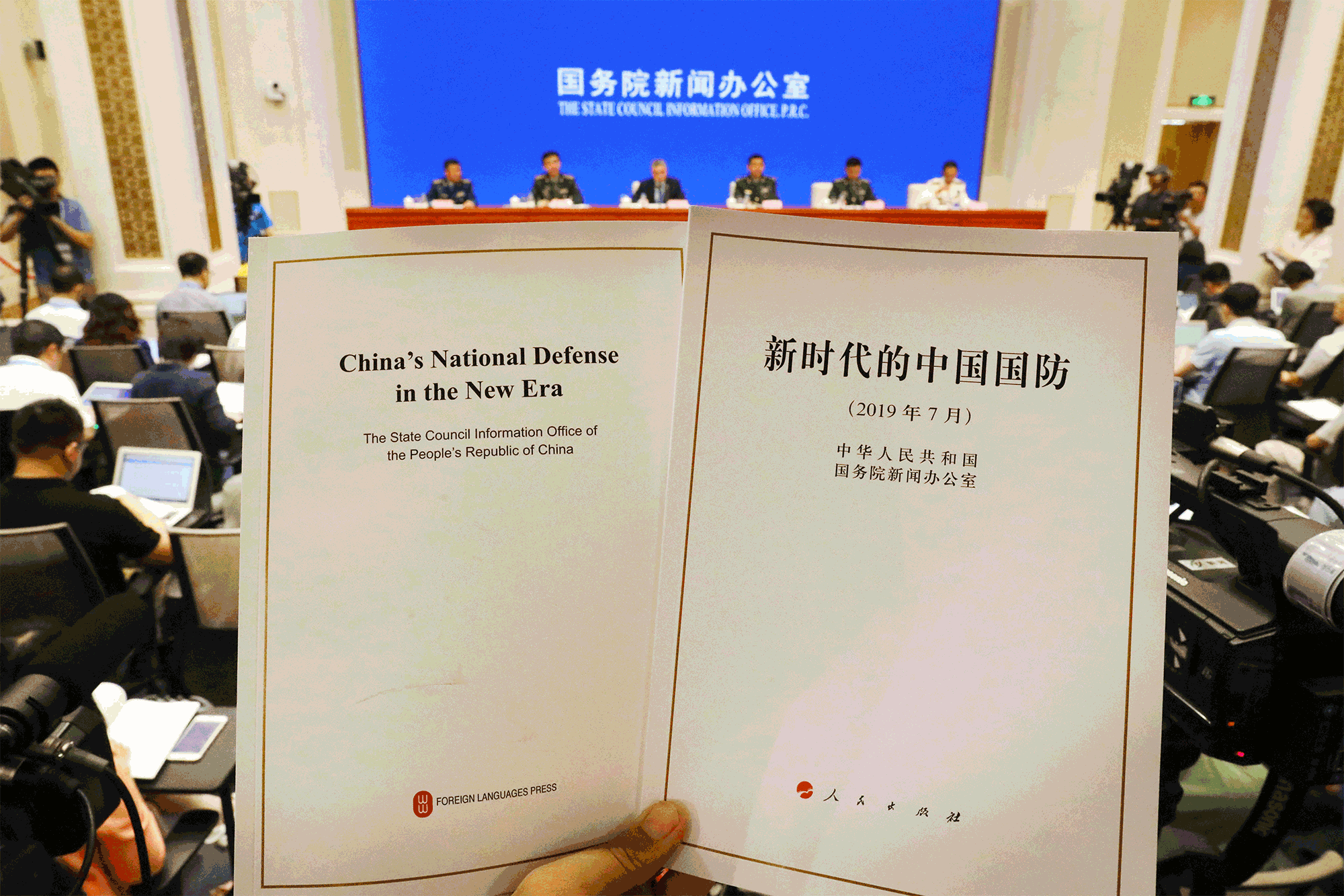
China’s naval evolution in the Indian Ocean Region has been shaped by a series of doctrinal shifts and defense white papers that progressively expanded the People’s Liberation Army Navy’s (PLAN) mandate from coastal defense to far-seas operations. The doctrine of “Near Sea Defense and Far Seas Protection,” formalized in the 2015 Defense White Paper, marked a pivotal transition, explicitly tasking the PLAN with safeguarding China’s maritime interests beyond its immediate periphery. This represented a significant departure from earlier postures. China is first Defense White Paper in 1998 reflected limited naval ambitions focused primarily on homeland defense.
A major turning point came in 2004 when President Hu Jintao, addressing the Central Military Commission, directed the PLA to defend China’s expanding national interests and contribute to safeguarding world peace, thereby enlarging the navy’s strategic scope. The 2006 Defense White Paper began to acknowledge security challenges related to energy supplies and international shipping routes, while the 2008 paper sharpened public emphasis on global resource competition and articulated the need for the PLAN to develop capabilities for cooperation and operations in distant waters. Subsequent documents built on this foundation: the 2010 paper stressed the importance of logistics support for out-of-area activities, and the 2013 paper explicitly endorsed the development of blue-water naval capabilities while enumerating specific missions for far-seas operations.
The landmark 2015 Defense White Paper delineated eight “strategic tasks” for the PLA, including far-seas protection, and provided the doctrinal framework for sustained presence in distant maritime domains. The 2017 and 2019 defense documents further elaborated these themes, explicitly linking naval development to the protection of Chinese interests and citizens overseas and offering strong support for the OBOR Initiative, thereby integrating economic expansion with military-strategic objectives in regions such as the Indian Ocean.
China's latest white paper, titled "China's National Security in the New Era", was released in May 2025. The document represented the first major official exposition of China's national security framework since the 2019 defense white paper, adopting a broader, holistic lens under Xi Jinping's "comprehensive national security concept" (introduced in 2014). It emphasized people's security as the ultimate goal, political security as the foundational task, and national interests as the guiding principle, while expanding coverage to domains including politics, military, economy, finance, culture, society, science and technology, cyberspace, ecology, resources, outer space, deep sea, polar regions, biology, artificial intelligence, and data. The document frames national security as comprehensive, systematic, and relative, rooted in 5,000 years of Chinese strategic culture, and positions it as essential for advancing Chinese modernization and contributing to a community with a shared future for mankind.
The 2025 white paper projects confidence in China's achievements—such as establishing the Central National Security Commission, enacting key laws (led by the National Security Law), formulating strategies like the National Security Strategy Outline and the 2021–2025 plan, and modernizing the security system through deepened reforms—while revealing underlying anxieties about an increasingly volatile global environment marked by major-power rivalry, external instability, and internal risks.
Maritime rights and interests received prominent treatment in the 2025 document, elevated from a defense-specific issue to a core pillar supporting steady modernization progress, reflecting Beijing's intent to integrate economic development with security in contested domains like the Indian Ocean and beyond.
China’s Maritime Domain Awareness in the IOR

China's Maritime Domain Awareness (MDA) in the Indian Ocean Region (IOR) relies on a layered, multi-domain architecture that integrates persistent surveillance, data fusion, and intelligence to monitor maritime activities, secure sea lines of communication, and support far-seas operations. This system enables real-time or near-real-time understanding of surface, subsurface, and aerial movements, often blending civilian and military (dual-use) elements under China's military-civil fusion strategy. Core components include space-based assets for wide-area coverage, surface and subsurface platforms for detailed local sensing, and supporting infrastructure for data processing and dissemination.
Space-based surveillance forms the foundational layer of China's IOR MDA. The BeiDou Navigation Satellite System (BDS), with over 50 operational satellites as of early 2026 and ongoing in-orbit upgrades, provides independent, high-precision positioning, navigation, and timing (PNT) services resilient to external disruptions. This supports precise tracking of Chinese vessels, submarines, and unmanned systems across the IOR. Complementing BeiDou are reconnaissance satellites like the Yaogan series (includes GEO platforms such as Yaogan-41 for continuous monitoring of the Indian Ocean) and commercial constellations (e.g., Gaofen and Jilin-1) that deliver high-resolution electro-optical, synthetic aperture radar (SAR), and multispectral imagery. These assets enable persistent detection of ships, aircraft, and infrastructure changes, feeding data into fusion centres for threat assessment and targeting support.
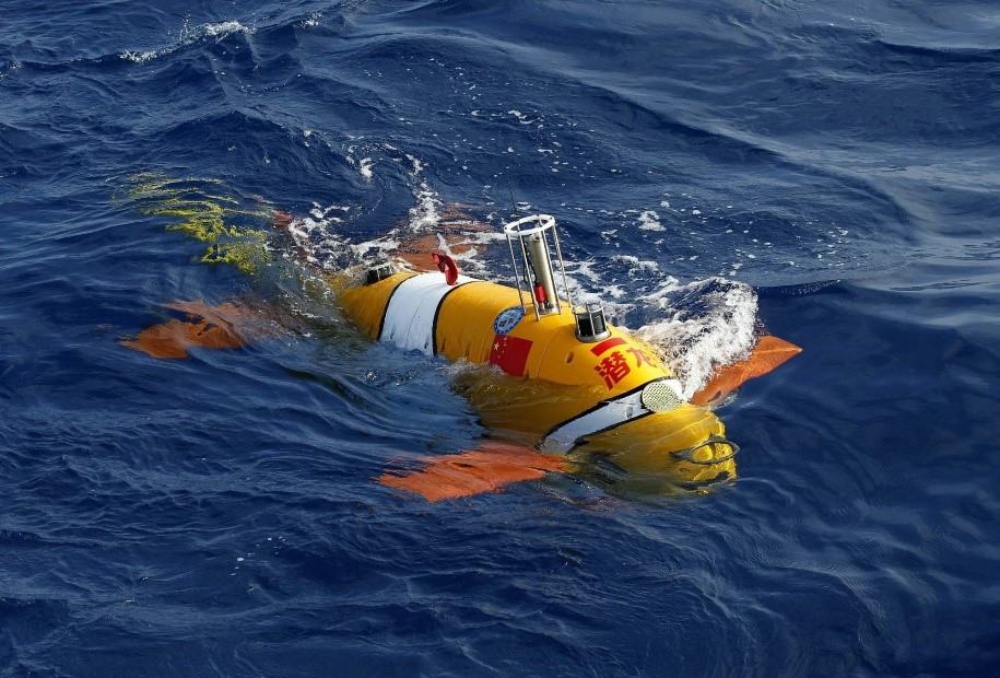
Surface and subsurface assets provide granular, on-scene awareness. China's extensive fleet of dual-use research and survey vessels (e.g., Shen Hai Yi Hao, Shi Yan series, Lan Hai vessels, and Da Yang Yi Hao) conducts persistent oceanographic surveys, seabed mapping, and acoustic profiling in the IOR. These platforms gather bathymetric, hydrographic, and environmental data critical for submarine navigation, anti-submarine warfare, and undersea infrastructure monitoring, while often docking in friendly ports (e.g. Sri Lanka, Maldives) to sustain operations. PLAN surface combatants, auxiliaries (e.g. Type 903A replenishment ships), and submarines add organic sensors (radars, sonars) during routine deployments, including anti-piracy task forces evolved into extended normalised presence since 2008. Distant-water fishing fleets, sometimes militia-affiliated, contribute to "swarm" normalization and passive surveillance.
Ground-based and supporting infrastructure complete the network. Overseas telemetry, tracking, and command (TT&C) stations in Africa, South Asia, and beyond, along with mobile Yuan Wang-class tracking ships (which are frequently deployed to the IOR), ensure reliable satellite control, data downlink, and real-time processing. Ground stations enhance BeiDou accuracy in littoral zones, while fusion centres integrate multi-source data for comprehensive situational pictures.
These elements enable China's incremental buildup of foundational MDA in the IOR—low-profile yet strategic—supporting energy security, gray-zone activities, and potential contingencies while challenging regional partners' visibility and response capabilities.
China’s Space Situational Awareness (SSA)
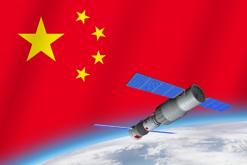
China’s Space Situational Awareness (SSA) capabilities are anchored by the Yaogan series of military reconnaissance satellites, with over 140 in orbit by early 2025. These include platforms equipped with synthetic aperture radar (SAR) for all-weather, day-and-night imaging and electro-optical sensors for high-resolution visuals. The Yaogan-41, launched in December 2023 and positioned in geosynchronous orbit (GEO), provides persistent, continuous surveillance over both the Pacific and Indian Oceans, capable of tracking objects as small as car-sized (including ships and aircraft). When paired with lower Earth orbit (LEO) and medium Earth orbit (MEO) constellations, this architecture enables real-time identification and tracking of U.S. and allied naval and air assets operating in the IOR. Complementary series such as Gaofen (high-resolution civilian/military imaging) and Haiyang (marine environment monitoring) further support dual-use maritime domain awareness (MDA), feeding integrated data streams to the People’s Liberation Army Navy (PLAN) for targeting purposes, including anti-ship ballistic missiles such as the DF-21D and DF-26.
Additionally, commercial constellations like the Jilin-1 series provide very high-resolution optical imagery (down to sub-meter level), often used in dual-use contexts to supplement military reconnaissance and enhance persistent monitoring.
The BeiDou Navigation Satellite System (BDS) serves as the critical Positioning, Navigation, and Timing (PNT) backbone for China’s SSA. Fully global since 2020, BeiDou delivers independent, high-precision services resilient to GPS denial or jamming, directly supporting military applications such as guiding missiles, submarines, aircraft, and ground forces during IOR operations. It enhances overall SSA by enabling precise own-force tracking, targeting accuracy, and coordination of unmanned systems, logistics, and command, control, communications, computers, intelligence, surveillance, and reconnaissance (C4ISR) in far-seas environments. BeiDou’s widespread global adoption—embraced by over 140 countries—extends Chinese influence, with IOR partners such as Pakistan and the Maldives integrating it for maritime and naval navigation, thereby normalizing and entrenching Chinese PNT dominance in the region.
Ground-based and maritime support infrastructure completes China’s SSA architecture in the IOR. Overseas telemetry, tracking, and command (TT&C) stations in Africa, South Asia, and the South Pacific help fill coverage gaps, while Yuan Wang-class tracking ships (e.g. Yuan Wang-5 & 6) are regularly deployed for satellite and missile tracking, addressing blind spots and raising concerns over monitoring of Indian activities. Newer vessels, such as Liaowang-1 (introduced in 2025), add mobile SSA for space and air objects, synchronizing naval operations with the space domain. These assets are inherently dual-use, supporting missile tests, satellite operations, and potential counterspace activities including jamming and proximity manoeuvres.
Emerging counterspace threats further strengthen China’s SSA posture. On-orbit SSA capabilities include more than 10 dedicated satellites for space object tracking, with proximity operations (RPO) and jamming tests documented in 2025. China’s counterspace toolkit—drawing on anti-satellite (ASAT) heritage and electronic warfare systems—threatens adversaries’ space assets, indirectly bolstering IOR dominance by degrading U.S. and Indian surveillance platforms such as India’s GSAT-7R naval communications satellite. Looking ahead, 2026 plans include the launch of the EYESAT constellation for enhanced debris and SSA monitoring, alongside lunar SSA projects that extend capabilities beyond geosynchronous orbit.
The implications of these developments for IOR maritime security are significant. China’s SSA enables persistent MDA over the region—tracking QUAD assets, monitoring chokepoints, and supporting gray-zone operations involving research vessels and IUU fishing fleets while contributing to escalation dominance in potential contingencies. From India’s perspective, these capabilities challenge Andaman-Nicobar Command MDA and the MAHASAGAR vision, exacerbating the three-front dilemma (land borders with China and Pakistan plus maritime threats). India counters through assets such as the GSAT-7R (launched in 2025 for enhanced naval communications and awareness) and QUAD supported Indo-Pacific MDA initiatives, highlighting the growing space dimension of maritime competition in the IOR.
China's position in Critical Minerals in the IOR

China plays a leading and highly strategic role in the exploration and potential exploitation of critical minerals in the Indian Ocean Region (IOR) seabed, establishing itself as the most aggressive player in this domain. It holds the highest number of International Seabed Authority (ISA) exploration contracts globally—five total across oceans, more than any other nation—securing exclusive rights to vast areas beyond national jurisdiction. These contracts are managed through state-backed entities such as the China Ocean Mineral Resources R&D Association (COMRA), China Minmetals Corporation, and Beijing Pioneer Hi-Tech Development Corporation, which operate under heavy government investment and direction.
The contracts cover all three major resource types: polymetallic nodules (rich in manganese, nickel, copper, and cobalt on abyssal plains), polymetallic sulphides (high in copper, zinc, gold, and other metals at hydrothermal vents along ridges like the Southwest Indian Ridge), and cobalt-rich ferromanganese crusts (containing cobalt, nickel, platinum-group elements, and rare earths on seamounts). This comprehensive portfolio positions China to access diverse seabed deposits essential for batteries, renewables, electronics, and defense technologies. Dual-use aspects are prominent: research and survey vessels map deposits while simultaneously collecting oceanographic, acoustic, and bathymetric data that supports submarine operations and maritime domain awareness (MDA).
The Strategic drivers include securing supply chains amid 2025 export controls on gallium, germanium, and rare earth elements (REEs); reducing import reliance on land-based sources; and actively shaping ISA rules through influence on standards (aligned with initiatives like China Standards 2035), liability limits, and governance norms via sustained participation in ISA negotiations.
China's advantages stem from substantial state funding, advanced deep-sea technologies (e.g., 10,000-mts. drilling ships, manned submersibles like Jiaolong, and ROVs/AUVs), and ongoing test plans for extraction prototypes. This positions Beijing for preferential exploitation rights once the ISA Mining Code is finalized, enabling long-term leverage in global critical mineral markets amid rising demand for the energy transition.
India emerges as a strong competitor in the IOR, holding multiple ISA contracts that reflect its own strategic push for self-reliance. These include polymetallic nodules in the Central Indian Ocean Basin (CIOB) since 2002 and recent polymetallic sulphides on the Carlsberg Ridge (contract signed in 2025, covering 10,000 km²). India's Deep Ocean Mission advances domestic technology through trials (e.g., Andaman Sea nodules in 2024), while applications for cobalt-rich areas (such as the Afanasy Nikitin Seamount) are partly motivated by concerns over China's expanding presence. Direct India-China competition manifests in overlapping interests across ridges and basins, carrying strategic implications for Andaman approaches, Bay of Bengal security, and QUAD led efforts to diversify global supplies away from dominant players.
Broader implications link economic and security dimensions. Seabed mining bolsters China's "Two-Oceans" strategy by safeguarding energy security (as IOR SLOCs carry much of its imports) and potentially enabling dual-use infrastructure. Governance risks arise as China shapes ISA rules, potentially favouring its operational practices. Environmental concerns and resource competition could escalate gray-zone tensions, such as vessel incursions near overlapping claims. Despite, opportunities exist for QUAD and India-U.S. cooperation on sustainable technologies, supply chain diversification, and multilateral norms to promote equitable and environmentally responsible development in the IOR seabed.
China's dependence on Maritime Supply Chains in the IOR
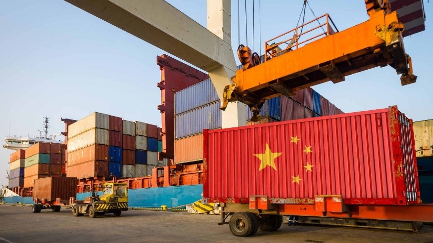
China relies heavily on the Indian Ocean Region (IOR) for its energy security and overall maritime trade, with approximately 80% of its crude oil imports and a significant portion of its liquefied natural gas (LNG) transiting through IOR sea lines of communication. Approximately two-thirds of China's maritime trade by value passes through or near the Malacca Strait and adjacent Indonesian straits, making these chokepoints critical arteries for both energy inflows and the export of manufactured goods. The IOR also serves as a vital conduit for other essential imports, such as minerals from Africa, and for exports destined for Europe and the Middle East. These dependencies heighten vulnerabilities to gray-zone risks—such as potential disruptions resembling Houthi-style attacks spilling over from adjacent regions—or to undersea threats targeting cables, pipelines, and shipping lanes, amplifying Beijing's strategic concerns about supply chain resilience in contested waters.
To mitigate these risks, China actively pursues alternative pathways and enhanced control through the OBOR Initiative, which has involved port and corridor investments across 90 countries, including key IOR nodes such as Gwadar (Pakistan), Hambantota (Sri Lanka), Kyaukpyu (Myanmar), and Djibouti. These developments aim to diversify routes, reduce reliance on vulnerable straits, and secure logistics and replenishment points for sustained operations. At the same time, seabed resources in the IOR particularly polymetallic nodules, sulphides, and cobalt-rich crusts represent a strategic frontier for critical minerals essential to batteries, electric vehicles, renewables, and defense technologies. China leads in securing International Seabed Authority (ISA) contracts in IOR-relevant areas (Southwest Indian Ridge), positioning itself for future access amid surging global demand and reinforcing long-term supply chain security.
China's dominance extends to processing and refining, where it controls roughly 60–90% of global capacity for many critical minerals, including rare earth elements and cobalt. Export controls tightened in 2025 (with partial pauses via U.S.-China negotiations) have underscored vulnerabilities in these chains, making the IOR an increasingly important transit and potential sourcing zone for African-origin minerals.
Regionally and globally, the “China Plus One” diversification strategy is accelerating, with manufacturing shifting to Southeast Asia (Vietnam, Indonesia) and India in sectors like electronics, automobiles, and batteries. India benefits from production-linked incentive (PLI) schemes, U.S.-India trade pacts, and nearshoring trends, emerging as a resilient alternative hub strategically located near IOR chokepoints. Proximity to the Malacca Strait and Bay of Bengal enhances India's leverage, while infrastructure upgrades (Andaman ports, Sagarmala program) and domestic rare earth corridors (notably in Tamil Nadu) directly counterbalance China's processing dominance and support diversified, secure supply routes in the region.
China's IUU activities in the IOR
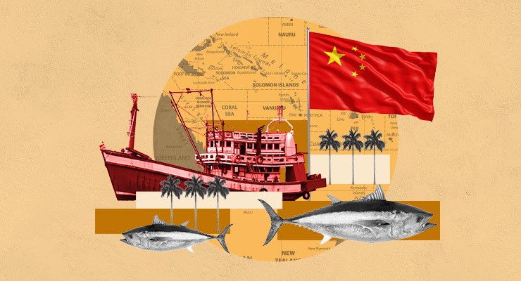
China's involvement in Illegal, Unreported, and Unregulated (IUU) fishing in the Indian Ocean Region (IOR) is characterized by the scale and persistence of its distant-water fishing (DWF) fleet, widely regarded as the world's largest and most active perpetrator of such activities. Chinese-flagged vessels, often linked to state-affiliated enterprises or maritime militia elements, dominate IUU incidents in the IOR, targeting high-value species like tuna, squid, shrimp, and reef fish across high seas and coastal EEZs. The fleet estimated at up to 16,000 vessels when including militia-linked and foreign-flagged craft—has expanded its presence, with hundreds of vessels deployed annually in hotspots such as the Southwest Indian Ocean (off the East Africa: Madagascar, Seychelles, Mauritius, Kenya, Tanzania) and areas near to the Bay of Bengal approaches. Tactics frequently include turning off Automatic Identification System (AIS) transponders to create "dark" vessels, operating without proper authorization in foreign EEZs, overfishing unregulated stocks (particularly squid on high seas), and exploiting legal ambiguities through foreign flagging or transshipment at sea to obscure origins and evade detection.
The economic and environmental impacts are severe, with coastal states in the IOR suffering substantial losses estimated at up to $142.8 million annually (2015–2021) for tuna and shrimp alone in countries like Kenya, Madagascar, Mozambique, South Africa, and Tanzania, though actual figures are likely much higher due to underreporting. Overfishing depletes shared stocks (>30% of IOR assessed fisheries unsustainable), damages ecosystems through bycatch (e.g. sharks, rays), and harms artisanal and small-scale fishers dependent on reefs and nearshore resources. Dual-use dimensions amplify security concerns as many vessels serve as platforms for intelligence gathering, domain normalization, or gray-zone coercion, clustering near strategic ports (e.g. Hambantota, Gwadar) or chokepoints to project presence under civilian cover.
Human rights overlaps compounding the issue, with documented cases of forced labour, debt bondage, violence, and poor working conditions aboard Chinese vessels, as highlighted in investigations by the Environmental Justice Foundation (EJF) covering the Southwest Indian Ocean. Legally, these activities violate UNCLOS obligations for sustainable use and flag-state responsibilities, as well as rules under regional bodies like the Indian Ocean Tuna Commission (IOTC), where China participates but faces criticism for under-reporting and exploiting management gaps (unregulated squid fisheries). While China ratified the Port State Measures Agreement (PSMA) in early 2025 and revised its fisheries law to emphasize "zero tolerance" for IUU domestically and align with international commitments, enforcement in distant waters remains inconsistent, with ongoing surges in unregulated operations and dark fleet behaviours noted through tracking data. This positions IUU in the IOR as a multifaceted non-traditional threat economic, environmental, and strategic demanding enhanced regional monitoring, multilateral responses via forums like IORA, Quad coast guard cooperation, and pressure on flag-state accountability.
Dual-use links significantly amplify the strategic dimension of these activities. Many Chinese fishing vessels are state-affiliated or militia-trained and equipped with surveillance capabilities, such as subsea sensors, hydroacoustic equipment, and advanced communication systems, blurring the line between commercial fishing and intelligence-gathering or strategic roles. This enables normalization of Chinese maritime presence near key sea lines of communication (SLOCs), strategic chokepoints, and foreign ports (Hambantota, Gwadar, Djibouti), where fleets often cluster under the cover of legitimate operations. The result is a low-visibility mechanism for domain awareness, presence projection, and potential coercion without triggering overt military responses, effectively extending China's gray-zone influence across the IOR.
China’s Core Dual-Use Capabilities in the IOR

China operates the world's largest fleet of oceanographic and research vessels—over 64 active platforms as of early 2026, many directly state-linked or government-supported—with numerous vessels equipped with dual-use sensors that serve both civilian marine scientific research (MSR) and military purposes. These platforms collect critical data including seabed mapping for submarine navigation, acoustic profiling for anti-submarine warfare (ASW), and hydrographic information for precise targeting and navigation. Activities in the Indian Ocean Region (IOR) are extensive and persistent, encompassing repeated surveys in the Bay of Bengal, Arabian Sea, near the Andaman approaches, and in proximity to strategic locations such as Diego Garcia (a major U.S. base). A notable surge occurred in November 2025, when four vessels clustered in the IOR, conducting overlapping and repeated patterns of bathymetric and acoustic data collection—information vital for People's Liberation Army Navy (PLAN) submarine patrols and broader undersea warfare capabilities.
The implications of these dual-use research vessel operations are profound. They enable the systematic buildup of foundational maritime domain awareness (MDA) essential for far-seas operations, allowing China to gather intelligence and maintain situational understanding without deploying overt warships. This low-profile, gray-zone approach normalizes Chinese maritime presence across sensitive areas, blurs the distinction between legitimate scientific inquiry and strategic reconnaissance, and supports incremental military advantage in contested waters while minimizing escalation risks.
OBOR linked ports and infrastructure across the IOR represent another core dual-use capability, offering civilian commercial functions alongside significant potential for military logistics, replenishment, and intelligence gathering. Facilities such as Gwadar (Pakistan), Hambantota (Sri Lanka), Kyaukpyu (Myanmar), and Djibouti provide berthing, fuel and supplies, and possible sensor or monitoring nodes, while frequently hosting Chinese research vessels and serving as gateways for extended operations. These ports enable “presence normalization” by sustaining routine Chinese maritime activity and exert economic leverage often described as debt-trap dynamics—that can translate into strategic influence or access concessions. Beijing’s incremental but sustained use has evolved anti-piracy task forces into routine far-seas deployments, while also supporting joint exercises (such as trilateral naval drills with Russia and Iran in the Gulf of Oman and Arabian Sea), further integrating these nodes into China's broader operational network.
Supporting elements reinforce and extend these dual-use capabilities. Auxiliary ships, including newly commissioned Type 903A replenishment vessels provide the logistical backbone for long-range PLAN operations by enabling sustained presence far from home ports. Distant-water fishing fleets, many with militia affiliations, contribute to “swarm” presence, resource control, and passive surveillance under civilian cover. Additionally, space and tracking support—exemplified by Yuan Wang-class missile and space tracking ships frequently deployed to the IOR ensures command, control, and data relay for missile tests, satellite operations, and integrated domain awareness, tying together surface, subsurface, and space-based elements of China's IOR strategy.
China's Deep-Sea Exploration in the IOR
China’s deep-sea exploration in the Indian Ocean Region (IOR) aligns closely with its 14th and 15th Five-Year Plans, which designate deep-sea capabilities as a top national priority and reflect Beijing’s broader ambition to achieve a “transparent ocean” battlespace where the undersea domain is fully surveyed, understood, and controllable.
To support this goal, China operates the world’s largest blue-water research fleet, comprising over 64 active vessels, many of which are modern platforms built or refitted post-2010. This fleet includes polar-capable ships as well as specialized vessels equipped with manned submersibles, remotely operated vehicles (ROVs), and autonomous underwater vehicles (AUVs), enabling extensive operations across distant maritime domains, including the IOR.
The key drivers of China’s deep-sea exploration efforts are both economic and strategic. Foremost is the pursuit of critical minerals at the same time, the collection of oceanographic, geological, and acoustic data directly supports PLAN’s far-seas operations, including submarine route planning, anti-submarine warfare (ASW) tactics, and vulnerability assessments of undersea cables and infrastructure. These activities are inherently dual-use as while framed as legitimate civilian marine scientific research (MSR) under UNCLOS, the data gathered provides significant military and intelligence advantages, allowing China to advance strategic objectives under the cover of peaceful scientific inquiry.
The dual-use and security implications of these efforts are substantial. The data collected enhances PLAN submarine patrols, ASW effectiveness, and targeting precision, while reinforcing China’s “two-oceans” strategy that integrates the Pacific and Indian Oceans into a cohesive maritime domain. India’s concerns center on the perception of “weaponized research,” with research vessels serving as intelligence, surveillance, and reconnaissance (ISR) platforms in gray-zone operations. Regulatory dynamics add another layer as China actively advocates for the timely opening of commercial seabed mining under the International Seabed Authority (ISA) framework but seeks to shape the emerging Mining Code in its favour often opposing proposed pauses on exploitation, stringent environmental inspections, or overly restrictive liability provisions. This combination of technological capability, strategic intent, and normative influence positions China’s deep-sea exploration in the IOR as a multifaceted challenge to regional maritime security and resource governance.
China’s Institutional Enablers: China Aid
China’s aid through the China International Development Cooperation Agency (CIDCA) branded as ‘China Aid’ in the Indian Ocean Region (IOR) serves as a key soft-power and influence tool, enabling Beijing to build goodwill, foster economic dependencies, and expand its strategic footprint. CIDCA was established in 2018 under the State Council specifically to coordinate China’s foreign aid and development cooperation, marking a deliberate shift from traditional “foreign aid” to “international development cooperation.” This approach aligns closely with Xi Jinping’s “Global Development Initiative” (GDI) and the UN 2030 Agenda for Sustainable Development. In the IOR, CIDCA emphasizes “small and beautiful” projects that are livelihood-focused and sustainable, alongside blue economy cooperation, disaster relief, and capacity-building efforts. These activities frequently complement OBOR Initiative infrastructure investments while creating regional forums to build consensus and normalize China’s role as a development partner.
The China-Indian Ocean Region Forum on Blue Economy Development Cooperation stands as CIDCA’s flagship platform for the IOR. Launched in 2022 in Kunming, the forum held its third session in December 2024 in Kunming. It concentrates on blue economy themes such as sustainable use of marine resources, fisheries management, maritime connectivity along with climate resilience, green development, and disaster prevention and mitigation. The key outcomes include commitments to train 20,000 “blue talents” from IOR countries between 2024 and 2026, the establishment of “Climate Early Warning Systems” and multi-country partnerships (with UNDP for early-warning initiatives in Pakistan and the Maldives), the inauguration of the China-Indian Ocean Region Maritime Cooperation and Training Centre in December 2024, and the promotion of digital tools such as the China-Africa Satellite Remote Sensing Application Cooperation Center, which has clear relevance for disaster and climate response across the IOR.
CIDCA delivers highly visible humanitarian and emergency aid, including disaster relief, food, and medical supplies. Recent instances include flood control and disaster relief assistance to Sri Lanka in 2025, additional emergency aid to Pakistan for flooding in 2025, and approximately $136 million in quake relief to Myanmar in 2025. During 2024–2025, China provided around 50 batches of humanitarian aid globally, with a particular emphasis on climate-vulnerable island and coastal states in the IOR. Livelihood and infrastructure projects remain people-centered and sustainable, focusing on health, education, agriculture, water, and housing. Notable IOR cases include seawater desalination equipment supplied to the Maldives, low-income housing projects in Colombo, Sri Lanka, and broader support in Pakistan—encompassing agriculture, healthcare, education, and digital infrastructure (e-government and satellite technology) often under the China-Pakistan Economic Corridor (CPEC) framework with over 20 agreements signed between 2024–2025.
Broader patterns show CIDCA signing memoranda of understanding (MOUs) and agreements during high-level visits, reinforcing normalized mechanisms with more than 17 IOR countries. These efforts align tightly with the GDI’s emphasis on shared development, South-South cooperation, and UN Sustainable Development Goals (UN SDG), particularly through green and climate-focused projects with partners like UNDP. The blue economy serves as a primary entry point for influence in resource-scarce states. From China’s perspective, CIDCA aid is framed positively as mutual beneficial, WIN-WIN cooperation, capacity building, and non-interference, advancing sustainable development without political strings.
However, the implications extend beyond development. CIDCA initiatives support dual-use enablers, including training centres and satellite/remote sensing capabilities that enhance maritime domain awareness (MDA) and intelligence gathering. China’s aid vector can be viewed as a soft-power extension of its broader maritime strategy, where economic goodwill often masks strategic gains. While practical and development focused, these activities intersect directly with security concerns, strengthening China’s IOR narrative and influence while raising questions about long-term leverage.
Way ahead
India’s geographic advantage is China’s disadvantage in the IOR as the latter faces the “tyranny of distance.” However, for China - these engagements in IOR are critical to establish its role as a credible security and developmental partner to its friends in the region and two, to secure its interests and protect its maritime vulnerabilities.
Unlike in the South China Sea (SCS), where Beijing faces multiple overlapping territorial claims and intense friction with neighbours like the Philippines, Vietnam, and others, China encounters no direct sovereignty disputes in the Indian Ocean region. This absence of historical or active territorial conflicts allows Beijing to position itself as a benign alternative to India and other western powers like the US, and UK, and former colonial entities whose influence in the area stems from colonial-era legacies, including bases like Diego Garcia (a joint US-UK facility) and lingering postcolonial arrangements. China by emphasizing economic partnerships through the OBOR Initiative, infrastructure development, and anti-piracy contributions presents its growing naval presence as cooperative and focused on securing shared sea lines of communication rather than asserting exclusive claims, thereby appealing to Indian Ocean littoral states.
China’s submarine and surface forces are growing both qualitatively and quantitatively propelled by a shipbuilding industrial base that has decisively overtaken the US in both commercial and military domains. As of 2026, the People's Liberation Army Navy (PLAN) operates the world's largest fleet with over 370 battle-force ships in stark contrast, the U.S. Navy hovers around 290–296 ships. China to not only expand its numerical edge but also rapidly integrate qualitative upgrades like improved quieting, longer-range missiles, and drone capabilities, positioning the PLAN to sustain its trajectory toward surpassing U.S. naval primacy in key metrics. This should also be of concern to India.
China’s next step in expanding its Indian Ocean presence highlights a notable gap in its current capabilities. The absence of permanent maritime reconnaissance (MR) aircraft or UAV bases in the region. Despite sustained anti-piracy deployments in the Gulf of Aden since 2008 and the operational logistics support base in Djibouti, no dedicated or permanent forward-operating sites for long-endurance maritime patrol aircraft (such as Y-8Q/Y-9 variants) or UAVs (like Chengdu GJ/Wing Loong series) have been established across the Indian Ocean Region (IOR) as of early 2026. This "missing" element limits comprehensive, persistent awareness and tracking of foreign warships particularly non-AIS-emitting naval assets relying instead on ship-based sensors, satellite ISR, occasional rotational deployments from mainland China, or opportunistic use of dual-use facilities. Observers note that while this shortfall persists even after 17+ years of Gulf of Aden operations, it appears non-urgent for Beijing's current posture, which prioritizes surface and submarine presence over constant aerial overwatch; however, addressing it through future basing or carrier-enabled UAV operations could significantly enhance domain awareness and close surveillance gaps against India and the U.S. in key chokepoints.
In the next 5–10 years, the Indian Ocean is poised to witness further escalation in China's military footprint, including the establishment of at least one additional dedicated or dual-use military facility and more routine deployments of its expanding aircraft carrier force beyond the Pacific. Recent assessments, including the U.S. Department of Defence’s 2025 report, project China aiming for up to nine aircraft carriers by 2035, enabling sustained blue-water operations; with carriers like the Fujian now operational and future nuclear-powered ones in development, periodic or rotational carrier strike group presence in the Indian Ocean becomes feasible to protect vital energy routes and project power. These developments will significantly intensify the growing maritime competition between India and China, as New Delhi perceives such moves as encroachments into its traditional sphere of influence, prompting heightened naval modernization, expanded basing (e.g., Andaman & Nicobar enhancements) and proactive diplomacy to counterbalance Beijing's IOR strategy.
*****
References
- Air University. (2025, September 8). ITOW: China's National Security in the New Era (2025).
https://www.airuniversity.af.edu/CASI/Display/Article/4273450/itow-chinas-national-security-in-the-new-era-2025 - Air University. (2025). 2025 China's National Security in the New Era [PDF].
https://www.airuniversity.af.edu/Portals/10/CASI/documents/Translations/2025-09-08%202025%20China%20National%20Security%20White%20Paper%202025.pdf?ver=nA5qS3sBOYidpEoW77qhfw%3D%3D - Andrew S. Erickson. (2019, July 23). China Defense White Papers—1995-2019—Download complete set + read highlights here.
https://www.andrewerickson.com/2019/07/china-defense-white-papers-1995-2019-download-complete-set-read-highlights-here - Andrew S. Erickson. (2025, May 5). New—285th iteration! Ron O’Rourke’s latest CRS report—“China Naval Modernization: Implications for U.S. Navy Capabilities”.
https://www.andrewerickson.com/2025/05/new-285th-iteration-ron-orourkes-latest-crs-report-china-naval-modernization-implications-for-u-s-navy-capabilities - Andrew S. Erickson. (2025, December 23). S. Department of Defense/War annual reports to Congress on China’s military power—2000 to 2025—Download complete set + read highlights here.
https://www.andrewerickson.com/2025/12/u-s-department-of-defense-war-annual-reports-to-congress-on-chinas-military-power-2000-to-2025-download-complete-set-read-highlights-here - Ars Technica. (2023, December 15). A top-secret Chinese spy satellite just launched on a supersized rocket.
https://arstechnica.com/space/2023/12/a-top-secret-chinese-spy-satellite-just-launched-on-a-super-sized-rocket - Center for Strategic and International Studies. (2024, January 19). No place to hide: A look into China's geosynchronous surveillance capabilities.
https://www.csis.org/analysis/no-place-hide-look-chinas-geosynchronous-surveillance-capabilities - Center for Strategic and International Studies. (2025). What China's 2025 white paper says about its maritime strategy.
https://www.csis.org/blogs/new-perspectives-asia/what-chinas-2025-white-paper-says-about-its-maritime-strategy - China International Development Cooperation Agency. (n.d.). China-Indian Ocean Region Forum on Blue Economy Development Cooperation. (Referenced in SCIO archives; see
http://english.scio.gov.cn/whitepapers) - Congressional Research Service. (2025, April 24). China naval modernization: Implications for U.S. Navy capabilities—Background and issues for Congress (CRS Report No. RL33153).
https://www.congress.gov/crs-product/RL33153 - Department of Defense. (2025). Annual report to Congress: Military and security developments involving the People's Republic of China 2025. U.S. Department of Defense.
https://media.defense.gov/2025/Dec/23/2003849070/-1/-1/1/ANNUAL-REPORT-TO-CONGRESS-MILITARY-AND-SECURITY-DEVELOPMENTS-INVOLVING-THE-PEOPLES-REPUBLIC-OF-CHINA-2025.PDF - Environmental Justice Foundation. (2024). Tide of injustice: Exploitation and illegal fishing on Chinese vessels in the Southwest Indian Ocean.
https://ejfoundation.org/resources/downloads/Tide-of-Injustice-SWIO-report.pdf - Environmental Justice Foundation. (2025). Trapped at sea: Exposing North Korean forced labour on Chinese vessels.
https://ejfoundation.org/resources/downloads/North-Korean-labour-Chinese-vessels-briefing-2025.pdf - Environmental Justice Foundation. (2026, February 19). Unseen and unaccountable: EJF investigation exposes governance failures in the South East Pacific squid fishery.
https://ejfoundation.org/news-media/unseen-and-unaccountable-ejf-investigation-exposes-governance-failures-in-the-south-east-pacific-squid-fishery - International Seabed Authority. (n.d.). Exploration contracts.
https://isa.org.jm/exploration-contracts - International Seabed Authority. (n.d.). Polymetallic nodules.
https://isa.org.jm/exploration-contracts/polymetallic-nodules - International Seabed Authority. (n.d.). Polymetallic sulphides.
https://isa.org.jm/exploration-contracts/polymetallic-sulphides - International Seabed Authority. (2025, September 16). Signing of the polymetallic sulphides contract between the International Seabed Authority and the Government of India.
https://isa.org.jm/news/signing-of-the-polymetallic-sulphides-contract-between-the-international-seabed-authority-and-the-government-of-india/ - International Seabed Authority. (2026, February 9). ISBA/31/C/3: Status of contracts for exploration and related matters.
https://isa.org.jm/wp-content/uploads/2026/02/ISBA_31_C_3-AUV.pdf - International Seabed Authority. (2026, March 6). ISBA/31/C/8: Application for extension of the contract for exploration for polymetallic nodules between the China Ocean Mineral Resources Research and Development Association and the International Seabed Authority.
https://isa.org.jm/wp-content/uploads/2026/03/ISBA_31_C_8.pdf - International Seabed Authority. (2025, March 9). ISBA/30/C/2: Status of contracts for exploration and related matters.
https://www.isa.org.jm/wp-content/uploads/2025/03/ISBA_30_C_2.pdf - Jones Day. (2026, January). Deep-sea mining: Navigating legal challenges [White paper].
https://www.jonesday.com/-/media/files/publications/2026/01/deepsea-mining-navigating-legal-challenges/2501455__deep_sea_mining_leg.pdf?rev=5433d248b1b14ee494efb702a590f272 - Maritime India. (2025, June 23). 2025 white paper on China's national security - Viewing holistic security through the Chinese prism.
https://maritimeindia.org/2025-white-paper-on-chinas-national-security-viewing-holistic-security-through-the-chinese-prism - O'Rourke, R. (2025, April 24). China naval modernization: Implications for U.S. Navy capabilities—Background and issues for Congress (CRS Report No. RL33153). Congressional Research Service.
https://www.congress.gov/crs_external_products/RL/PDF/RL33153/RL33153.284.pdf - Poseidon Aquatic Resource Management. (2025). The Illegal, Unreported and Unregulated Fishing Risk Index: 2025 update.
https://iuufishingindex.net/downloads/IUU-Report-2025.pdf - (2023, December 15). China launches large classified optical satellite towards geostationary orbit.
https://spacenews.com/china-launches-large-classified-optical-satellite-towards-geostationary-orbit - State Council Information Office of the People's Republic of China. (2015). China's military strategy.
http://english.www.gov.cn/archive/white_paper/2015/05/27/content_281475115610833.htm - State Council Information Office of the People's Republic of China. (2019, July 24). China's national defense in the new era.
http://english.scio.gov.cn/whitepapers/2019-07/24/content_75026825.htm - State Council Information Office of the People's Republic of China. (2025, May 13). Abstract of white paper on China's national security in new era.
http://english.scio.gov.cn/whitepapers/2025-05/13/content_117871660.html - State Council Information Office of the People's Republic of China. (2025). China's National Security in the New Era. (Full text via Air University translation).
- S. Naval Institute. (2025, December 24). China wants nine aircraft carriers by 2035, says new Pentagon report.
https://news.usni.org/2025/12/24/china-wants-nine-aircraft-carriers-by-2035-says-new-pentagon-report - S. Select Committee on the Chinese Communist Party. (2026, January). China's global fishing offensive. U.S. House of Representatives.
https://chinaselectcommittee.house.gov/sites/evo-subsites/selectcommitteeontheccp.house.gov/files/evo-media-document/final-china-s-global-fishing-offensive-compressed-1.pdf - War on the Rocks. (2019, August 12). Steady as she goes: China's new defense white paper.
https://warontherocks.com/2019/08/steady-as-she-goes-chinas-new-defense-white-paper - Air University. In Their Own Words series (translations of Chinese defense documents).
https://www.airuniversity.af.edu/CASI/In-Their-Own-Words - CSIS ChinaPower Project. (2026, February 5). Tracking China's increased military activities in the Indo-Pacific in 2025.
https://chinapower.csis.org/china-increased-military-activities-indo-pacific-2025 - Environmental Justice Foundation. (Various). Reports on Chinese distant-water fishing and IUU in Southwest Indian Ocean.
https://ejfoundation.org/resources - International Seabed Authority. (2025–2026). Multiple ISBA documents on exploration contracts (e.g., ISBA/30/C/2, ISBA/31 series).
https://isa.org.jm/documents - Ministry of Foreign Affairs of the People's Republic of China. (2025, November 27). China releases white paper on arms control in new era.
https://www.fmprc.gov.cn/mfa_eng/xw/wjbxw/202511/t20251127_11761653.html - State Council of the People's Republic of China. (Various). White papers archive.
https://english.www.gov.cn/archive/whitepaper
Disclaimer: The views and opinions expressed in this article are those of the author(s) and do not necessarily reflect the official position of the Deccan Centre for International Relations.